
Georgia Tides & Carolina Tides
by Leon Calcutt
Version 2.0.0 💾 2 Mb
📅 Updated May 5, 2015

Features Georgia Tides & Carolina Tides
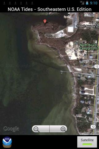
Easy to use, Satellite Map based NOAA tide charts of the entire Southeastern U.S.
marine tide stations on a simple to use satellite map.
SIMPLE TO USE, NO SPAM ADS...100% AD FREE.
Covers these tide charts: Georgia tides, South Carolina tides, North Carolina tides and Virginia.
Optional PRO subscription service for users to access complete LIVE weather satellite and forecasts from the OFFICIAL National Weather Service within the app.
Added Sunrise/Sunset and Moonrise/Moonset and Moon Illumination and Age.
NEW!
Added ability to share tide charts via Facebook or Email.
East to Use, advanced tide graphs allow for you to judge the level of water movement for optimal fishing between high and low tide.
Ability to forecast tides from NOAA by setting date and period for any of the tidal stations for the entire South East Coast of the U.S.: Georgia, North Carolina, South Carolina and Virginia.
When GPS is available we auto-locate your position and zoom to the map for surrounding NOAA tide stations near you.
Included is the ability to zoom and view satellite imagery for fishing ground characteristics to compare with tide movement.
Social Features
Connect and share with friends and the community.
Weather Features
Get accurate weather forecasts and real-time updates.
Fitness Tracking
Track your workouts and monitor your health metrics.
See the Georgia Tides & Carolina Tides in Action


Get the App Today
Available for Android 8.0 and above